![]()
![]()
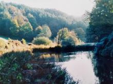 |
Dimmingsdale ponds This is a series of fishing ponds thought to have been established in the late 18th or early 19th century. This is a SSSI open access area.
Please add your photos of this place to the site. Map location: SK05134316 Dimmingsdale, Oakamoor |
 |
Drum plinths These large stone foundations used to belong to the "drum" that was used with the endless steel rope to pull the empty carts of the 1847 rack railway back up the inclined plateway with the weight of the full carts going down. |
|
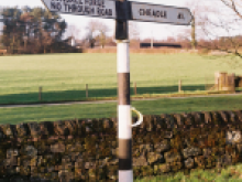
Dunwood Milepost Longsdon A listed early 19th century cast iron milepost, which gives distances to Leek, Newcastle and Burslem. Longsdon |
|
|
Egg Well Bradnop A 20th Century brick building, covering the ancient well Bradnop |
|
|
Enclosure, Revedge Farm, Bradnop A circular walled enclosure, possibly used for keeping stock, which was extant by the late 19th century. Bradnop |
|
|
Entrance gate Piers to Ashenhurst Bradnop Entrance gate Piers to Ashenhust Bradnop. Bradnop |
|
 |
Finger post, Consall 1930's finger post. Moved from Consall village when SCC removed old style finger posts in 1960s. SJ999490 Consall |
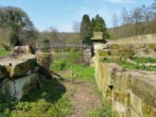 |
Flood lock, Uttoxeter Canal Former canal lock on the now disused Uttoxeter Canal. 2017 there are volunteer work parties led by Caldon & Uttoxeter Canal Trust to preserve these heritage features. Not listed. SK093424 Uttoxeter Canal |
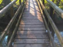 |
Footbridge near Ross Bridge, Whiston This wooden footbridge crosses the Churnet near Ross Bridge, Whiston. whiston |
|
Former Alton Tollhouse 19th century. Brick with slate roof, situated on Denstone Lane at Alton Gate. SK08004159 Alton, Denstone |